Construction sites change every day. Walls go up, services are installed, ceilings are closed and, within weeks, much of what was built is hidden from view.
For project teams, that creates a familiar problem. When a question comes up later about what was installed, when it was installed or what the site looked like before a ceiling was closed, the answer often depends on scattered phone photos, site diaries and memory.
360 cameras offer a more complete alternative. Instead of capturing a single framed photo, a 360 camera records the entire surrounding space in one shot, allowing anyone on the project to virtually stand in that spot and look around.
Used well, 360 capture becomes a visual record of the whole project, not just a collection of images.
What is 360 site capture?
A 360 camera uses multiple lenses to capture a full spherical image of its surroundings. When these images are taken at planned locations and organised by date and floor plan position, they form a navigable record of the site at different points in time.
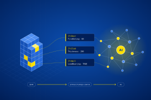
Modern workflows often go a step further. Captures can be pinned to drawings, compared across dates and, in some platforms, viewed alongside the BIM model for the same location.
The result is a way for stakeholders to “walk” the site remotely and see how it has progressed over time.
How are 360 cameras used in construction?
360 capture supports a wide range of everyday project activities:
- Progress monitoring: regular captures show what has been completed between site visits.
- Remote inspections and reviews: consultants, clients and managers can review site conditions without travelling to site.
- Pre-closure records: capturing services before walls and ceilings are closed creates a reference for future maintenance and investigation.
- Defect and issue documentation: problems can be recorded in their full context, not just as close-up photos.
- Progress claims and disputes: dated visual records help support discussions about what was completed and when.
- Handover and facilities management: building owners receive a visual history of the asset, including hidden installations.
The common thread is context. A 360 image shows not only the item of interest but also everything around it.
360 cameras vs laser scanning: which do you need?
360 cameras and laser scanners are sometimes discussed as alternatives, but they serve different purposes.
A 360 camera produces a visual record. It is fast, relatively inexpensive and easy for non-specialists to use, which makes it well suited to frequent progress capture across large areas.
A laser scanner produces a measured record in the form of a point cloud. It is used when accurate dimensions matter, for example to verify as-built conditions against design, check tolerances or create an as-built BIM model through scan-to-BIM.
360 capture answers “what does the site look like?” Laser scanning answers “exactly where is everything?”
Many projects benefit from using both: 360 capture for regular, site-wide visual records, and laser scanning at specific stages where measurement and verification are needed.
What are the challenges of working with 360 cameras?
The camera itself is usually the easy part. The real challenge is capturing usable, consistent information on a working site.
Lighting
Construction sites often have poorly lit areas, especially in basements, risers and enclosed rooms. Dark or unevenly lit captures lose much of their value. Temporary lighting, or scheduling captures when site lighting is available, makes a significant difference.
Camera setup
Camera height, stability and settings affect image quality and comparability. A monopod or tripod at a consistent height helps keep captures level and comparable over time, and keeps the person taking the image out of the shot.
Consistent capture locations
Progress is only easy to compare if images are taken from the same positions each time. Without a planned route and marked capture points, teams end up with images that cannot be meaningfully compared between dates.
Storage and organisation
360 images are large files, and a regularly captured project can quickly generate thousands of them. Without clear naming, dates and links to floor plan locations, finding the right image later becomes a project in itself.
A 360 capture is only useful if someone can find the right image, from the right location, on the right date.
Connecting 360 capture with BIM
The value of 360 capture increases when it is connected to the rest of the project’s digital information.
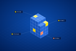
When captures are linked to drawings and organised in a common data environment, teams can compare what was planned with what has actually been built, raise issues against the right location and keep site records alongside models and documents rather than in separate folders.
This is the same principle that applies across digital delivery: information is most useful when it is structured, located and accessible to the people and systems that need it.
A simple workflow to get started
Teams do not need a complex system to begin. A disciplined, repeatable routine matters more than the equipment.
Define the purpose.
Decide what the captures need to support: progress reporting, pre-closure records, client updates or handover.
Plan the capture route.
Mark capture points on the floor plans so the same positions are used every time.
Set a capture schedule.
Capture at regular intervals and at key milestones, especially before walls and ceilings are closed.
Standardise the setup.
Use the same camera height, settings and mounting method for every capture.
Organise as you go.
Store each capture with its date, level and location, ideally linked directly to the drawing.
Review against the design.
Compare captures with drawings or the BIM model to identify deviations early.
Share with stakeholders.
Give consultants, clients and site teams access so the record is used, not just stored.
At AcePLP, we help project teams connect site information with their wider digital workflows, from BIM services and coordination to data management and model-based verification.
A 360 camera captures the site. A good workflow turns those captures into project information people can rely on.
Frequently Asked Questions
What is a 360 camera used for in construction?
A 360 camera captures a full spherical image of a space in a single shot. In construction, it is used for progress monitoring, remote inspections, recording services before walls and ceilings are closed, documenting defects and creating a visual record for handover and facilities management.
Can 360 cameras replace laser scanning?
Not for tasks that require accurate measurement. 360 cameras produce visual records, while laser scanners produce measured point clouds used for as-built verification, tolerance checks and scan-to-BIM.
Many projects use 360 capture for frequent, site-wide visual records and laser scanning at specific stages where precise dimensions are needed.
How often should a construction site be captured with a 360 camera?
It depends on the purpose and the pace of the project. Many teams capture at regular intervals, such as weekly, and add extra captures at key milestones, particularly before walls, ceilings or floors are closed.
Consistency matters more than frequency. Capturing from the same locations each time is what makes progress comparable.
What makes a 360 capture useful later in the project?
Good lighting, a consistent camera setup and planned capture locations make images clear and comparable. Just as important is organisation: each capture should be stored with its date, level and location so the right image can be found quickly when a question comes up.
Can 360 site captures be linked to BIM models?
Yes. Depending on the platform, 360 captures can be pinned to drawings, organised within a common data environment and, in some cases, viewed alongside the BIM model for the same location. This helps teams compare planned and actual conditions and raise issues against the right part of the project.
How can a project team start using 360 cameras?
Start with a clear purpose, such as progress reporting or pre-closure records. Then plan capture points on the floor plans, set a regular schedule, standardise the camera setup and store every capture with its date and location. Finally, make sure the captures are shared with the people who need them, so the record is actually used.